Census 2011
District population : 78,690
Growth : 37.62%
Sex Ratio : 1029
Literacy : 60.02

Brief About East Kameng District
East Kameng district is situated in the Western
part of Arunachal Prdesh which exactly lies to the east of West
Kameng District. The area of the district is 4134 Sq. Kms with
headquaters at Seppa. It is lying between 92.36' E and 93.24'
E longitudes and 26.56' to 27.59' N latitudes. The district is
predominantly habited by the Scheduled Tribes. the major tribes
inhabitating this district are Nishang, Akas, Myis and the Puroiks
(Sulung). The HQ of this district is Seppa.
Brief History
Till 1914, East Kameng was part of Darang District of Assam. By
Govt. of India's notification of 1914, the area covered by this
district became part of the western Section of the North east
Frontier Tract. This tract was renamed in 1919 as Balipara Tract
with its headquarter at Charduar, Assam. In 1946 the area coovered
by Balipara Tract was divided into Sela Agency and Subansiri Area
and the hqr. continued to be at Charduar. In 1954, Sela Agency
was renamed as the Kameng Frontier Division with its hqr at Bomdila.
In 1965 Kameng Frontier was renamed Kameng District. In 1980,
the district was bifurcated into two districts namely East Kameng
(Formerly known as Sepla Subdivision) and West Kameng (formerly
known as Bomdila subdivison). Now it has become an independent
district with its hqr at Seppa (Till 1975, Seppa was Sapla meaning
marshy land in local dialect). The name Kameng has been derived
from the Kameng river originating from the glacier lake below
Gorichan mountain and is one of the tributaries of River Brahmaputra.
The entire district, except a small area on the southern most
tip bordering Assam, is mountainous.
Location and Physical
Features (Geography)
East Kameng district is situated in the Western part of Arunachal
Pradesh surrounded by West Kameng in the west, Papumpare in the
East, Part of Lower Subansiri and Macmohan (International Boundary)
line in the North and Sonitpur District of Assam in the South
covering an area of 4134 sq kms. The entire district barring a
small area on the southernmost tip of Assam is mountainous. The
deep gorges and narrow valleys frequently open into wide valleys.
The district is an extension part of the North eastward Himalayan
range. It lies between 92° 36" E to 93° 24" E longitudes and 26°
56" to 27° 59" Latitudes. The District Hqr, Seppa lies on the
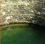
bank of River Kameng. Important tributaries of river Kameng which
are turbulent and high speed rivers are Para, Pachi, Pachok, Pakoti,
Keya Bichom, Pacha, Pakke, Papu, Passa, Narmorah and Dikalmukh.
The rugged terrains of the district make transport and communication
extremely difficult. There are few surface roads, which remain
cutoff during summer seasons due to flood and landslide.
Climate
The climatic condition of this district varies largely with topography
and altitude. The altitude of different administrative centres
varies ranging from 362 m to 1906 m. The foothill zone is subtropical
and has hot and humid climate. Average temperature decreases as
elevations increase in the mountains. The district experiences
heavy rainfall averaging 287 mm falling mostly between June and
October and in winter extreme cold. As a result of heavy rainfall
during monsoon season, most of the rivers and streams are highly
inflated and disrupt normal transport system and communication.
Although heavy monsoon helps regeneration of forests, it is also
responsible for speedy soil erosion and landslides which make
the maintenance of roads quite costly. Many developing activities
are held up during the monsoons. The months from October to March
are the most favourable time for intensive work for development.
PEOPLE AND CULTURE (LANGUAGE & ART FORMS
ETC)
The Major tribes inhabiting this district are Bangnis(Nyishi),
Akas, Mijis and Puroiks (Sulung). Each tribe has their own dialects,
customs, and religion. Social and cultural events are very much
associated with their life, environment and other relevant activities.
The Bangnis also called Nishi, Nishang, Nissi
or Dafla and Sullungs inhabit the area contagious to the North
Earstern Kameng extending upto Lower Subansiri District. The Akas
inhibit the Bana Area and Mijis inhibit to the region eastern
of West Kameng District i.e., Lada Circle.
The Marriage of the Bangnis takes place through
the process of formal negotiations between the parents of both
parties. After a stipulated bride price payment, the girl comes
to live with the husband. There are no formal ceremonies which
mark the consummation of marriage. The husband and the wife both
clad in clothes and wear a number of ornaments. Polygamy is very
common.
The Sulungs (Puroiks) are a very scattered tribe.
The Sulung society is based on the unit of village community.
The Sulungs own land but in some cases they are dependent upon
their Bangni Master.
The Festival of the Bangnis is Nyokum Yullo which
is celebrated in the month of Februaly. The local priest (Nibu)
does the devination by examining the liver of a fowl and the yolk
of an egg respectively. The site where the festival is performed
is called Nyokum Kyageng. The Sulungs celebrate Gumkum Gumpa in
the month of April.
Administration
Other
Departments