| Census
2011
District population : 36,82,713
Growth : 17.60%
Sex Ratio : 917
Literacy : 68.48

Brief About Bijnor District
Binor, or more correctly Bijnaur, occupies the north-west
corner of the Rohilkhand or Bareilly Division, and is a roughly
triangular stretch of country with its apex to the north. The western
boundary is formed throughout by the deep stream of the river Ganges,
beyond which lie the four districts of Dehradun, Saharanpur, Muzaffarnagar
and Meerut, all belonging to the meerut Division. To the north and
north-east in the hill country of Garhwal, the dividing ling being
the submontane road, which runs from Hardwar along the foot of the
Himalayas to Ramanagar, Haldwani and Tanakpur. This road, popularly
known as the Kandi Saradk, belongs throughout its length to Garhwal,
the transfer having taken place a few years since. On the east the
Phika river for the greater part of its course constitutes the boundary,
separating this district from Naini Tal and Moradabad, as far as
its junction with the Ramganga; and to the south lie the Thakurdwara,
Amroha, and Hasanpur tahsils of Moradabad, the boundary being conventional
and undetermined by natural features. The extreme parallels of north
latitued are 29 2' and 29 58' and of east longitude 78 0' and 78
57' from Lalitpur, the most northerly point, to koti Rao in the
furthest eastern corner the distance in 56 miles; and from koti
Rao to Kamharia in the south-westerly angle 57 miles; and from Kamharia
to Lalitpur 62 Miles. The total area of the district is liable to
change slightly from time to time by reason of the erratic action
of the Ganges and Ramganga: in 1906 it amounted to 1,145,272 acres
of 1789-5 square miles, the average for the last five years being
1,147,967 acres.
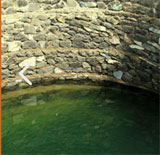
There remains the low fringe of khadir along the
Ganges to the west. This generally resembles the lowlands that skirt
the rivers of the interior, the low flats which adjoin the stream
itself being purely alluvial in character, while above them rises
a terrace of higher ground extending inland as far as the chain
of staguant morasses lying immediately under the bangar cliff. But
the khadir in the district, at any rate in the southern parganas,
in of a very poor description and no whit better than that on the
opposite bank in Muzaffarnagar and Meerut.
The common tongue of the people in the Urdu or
Hindustani dialect of western Hindi. It has sometimes been classified
separately as Rohilkhandi, but there is really no marked distinction
in idiom or vocabulary between this and Hindustani. The last census
returns show that the entire population, with the exception of a
minute fragment of 740 persons in all, gave Western Hindi as their
mother-tongue, and there is no district in the United provinces
in which Urdu is more widely spoken, both by the peasants and the
educated classes. The other languages enumerated were Punjabi, Pahari,
Marwari, Bengali and English, the last occurring in 35 cases only
This district belongs to Moradabad division of
UTTAR PRADESH.
FUNCTIONS OF DISTRICT
MAGISTRATE/COLLECTOR
District is the main unit of the state. The District
Magistrate/Collector is the administrator of the district . The
most important work of the the district magistrate is to maintain
law and order, various rules and implementation of various govt.
orders. Being a top administrator of the district , he directly
order the police department whenever required. He is also responsible
to maintain peace and justice in the district.
As a collector the most important works of the
district magistrate are:
1. to collect the land revenue, main and miscellaneous
dues of the government
2. proper maintenance of the Land Records
3. Land acquisition
4. Settlement of the refugees.
5. To provide the help to the public during the natural calamities
like drought, flood and earthquake.
6. To maintain the accounts of receipts and payments in the district
treasury by the help of the Treasury Officer and send the details
to the government.
7. To implement all the government programmes in the interest of
the common public of the district.
8. to make availability of all the consumable items under public
distribution system to the fair price shops by the help of the District
Supply Officer.
9. to conduct all national/state/local level elections peacefully.
For planning purpose district
is divided into Blocks . These are :-
| S
No |
Block
Name |
S
No |
Block
Name |
|
| 1 |
NAJIBABAD |
7. |
NEHTAUR |
| 2 |
KIRATPUR |
8. |
DHAMPUR |
| 3 |
MOHD. DEOMAL |
9. |
SEOHARA |
| 4 |
HALDAUR |
10. |
JALILPUR |
| 5 |
KOTWALI |
11. |
NOORPUR |
| 6 |
AFZALGARH |
|
|
There is one Dy.Dir.Chakbandi and one settlement
officer (Chakbandi) for chakbandi operation running in 426 villages
out of 3024 revenue villages..
According to general and revenue administration,
Bijnor is divided into five sub divisions Sadar, Chandpur, Dhampur,
Nagina, Najibabad. The area of each subdivision includes the
area of each tehsil. Every tehsil comes under S.D.M.,
acts as an assistant collector for revenue administration. Also
there is one Tehsildar in each tehsil who is assisted by additional
Tehsildar, Nayab Tehsildar (for each pargana). Tehsildar acts as
2nd-class magistrate for his tehsil and helps Assistant Collector
(S.D.M.) for running the revenue administration properly. Tehsildar
works as an officer incharge for its tehsil office and revenue court.
His work mainly includes collection of all dues, maintenance
of Land Records, disposal of revenue cases and welfare of
general public. Tehsildar is also incharge of sub treasury office
located in his tehsil.
For better administration tehsils are segmented
in paragnas. Each pargana is headed by a Nayab Tehsildar. He is
assisted by Kunoongo and Lekhpals |