Census 2011
District population : 95,219
Growth : 104.15%
Sex Ratio : 915
Literacy : 77.95

Brief abour Peren District
PHYSIOGRAPHY: Peren District is a strip of mountainous
territory having fertile foothill valley plains in
North-West and North-East. It occupies the elongated South-Western
end of Nagaland State.
LOCATION: Peren District is located between longitude
93°E - 94°E and latitude 25° N-26°N of the Equator.
DISTANCE OF HEADQUARTER: From State Capital = 139 K.M. via Kukidolong
,From Airport = 71 K.M. ,From Railhead, Dimapur = 77 K.M.
AREA: Peren District has a total area of 2300sq
k.m.
LANGUAGES: Zeme, Liangmai, Kuki, Rongmai, English,
Tenyidie, Nagamese and Hindi.
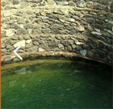
A view of Peren(Benreu Village, home of Zeliang Naga)
BOUNDARY: Peren District is bounded by 2 (two)
States and 2 (two) Districts. On the East and South it shares
Nagaland’s Inter-State boundary with Manipur;
on the west also it shares Nagaland’s Inter-State boundary with
Assam; and on the North and North-East it is bounded by two Districts
of Nagaland - Dimapur
and Kohima, respectively.
ALTITUDE : The altitude of the District varies
from 800 mts. to 2500 mts. above the sea level. Mt. Paona, the
highest mountain peak in the district is 2500 mts.
high and Peren Town, the Headquarter is 1445.40 mts. above sea
level.
RIVERS : The principle rivers and important
rivulets that flows through Peren District includes Tepuiki, Mbeiki
(Barak), Ntanki, Mungleu, Tesanki, Nguiki, Nkwareu, Techauki,
Ngungreu,Tahaiki and Duilumreu (Tributary of Tepuiki).
POPULATION: The population of Peren District
is entirely tribal. The original inhabitants of Peren District
are people who originated from Nkuilwangdi, presently in Senapati
District of Manipur. As per 2001 Census, the total population
is 96,825 of which 50,001 are Male and 46,823 Female. Circle wise
break up of population is :
Peren Sadar = 12,882, Ngwalwa Circle = 08,771, Jalukie Circle
= 22,006, Ahthibung Circle = 13,481, Nsong Circle 07,441, and
Tening Circle = 31,243.
LITERACY RATE: The Literacy rate of the District
as per 2001 Census is 54%, of which 32% are Male and 22% are Female.
Villages Electrified : 66 villages.
Number of Major Towns : 3 (Peren Town, Tening Town , and Jalukie
Town)
Number of Small Towns : 3 (Nsong Town, Ngwalwa Town and Athibung
Town)
Number of Recognized Villages : 85
Number of Unrecognized Villages : 10 (Under process for recognition).
AGRICULTURE
About three-fourth of the population are involved in agriculture.
Rice is the staple food crop grown. Peren District also has a
unique land holding pattern in that almost
90% of the area is privately owned. There is no landless among
the inhabitants of the District, as each Possess land, either
his own, or inherited from his family, clan
or village. Although agriculture is the main-stay of the District,
self-sufficiency in food-grain is yet to be achieved. Considering
the hilly terrain of three-fourth of the area,
this is not unusual but the main drawback is that cultivation
is vitiated by Jhumming. The only answer to this is to encourage
terraced cultivation, contour bunding, farm forestry, orchard
plantation and cash crop plantation so as to discourage Jhum cultivation
which leads to soil erosion, loss of fertility, deforestation
and low yield. The Government need to turn its sincere attention
to the vast fertile plains of the District viz., Jalukje, Ahthibung,
Heninglcunglwa Ngwalwa, Gaili and Punglwa to practically translate
these into the Rice Bowl of Nagaland, besides industrial and horticulture
prospects these areas holds. Whereas the farmers in the North,
Northeast and West foot hills and valleys depends on rivers like
Nkwareu, Mungleu, Techauki, Ngungreu, Tahailci, Ntankj, Tesangki
etc, water source for paddy fields in the foot hills in the East
and South originates from Doidieki (Dzuku).
MINERAL
Necessary facilities and infrastructure in the District is zero,
but mineral wealth is immense, though unexplored as yet. For instance,
Lalong village under Nsong Circle literally sits atop rich deposits
of iron-ore.
HYDRO PROJECTS
Peren District takes pride in having I (one) Mini Hydro Project
at Duilumreu, Poilwa. Both the First as well as the Second phase
has been commissioned. The District, however, is yet to directly
benefit from its only Hydro Project as power generated from this
Project is being supplied to Kohima only.
INDUSTRIES
The artistic sense of the inhabitants of the District indicates
Promising future in Industry. However, the Government is yet to
take serious notice of this Potentiality.
TOURISM
This remote hilly area covered with luxuriant vegetation and
unique forests, cool and bracing climate, scenic beauty of the
terrain, enchanting rivers and rivulets, presence of wide variety
of wild animals and birds, birds-eye view of the neighboring Manipur
and Assam, and the hospitable and likeable nature of the inhabitants
indicates promising future for tourism industry. Moreover, the
rich cultural heritage of the Zeliangs including festivals and
dances are added attractions. Places of tourism Potentiality includes
historical places like the Mt. Kisa at Nzauna village situated
at the southernmost end of the District and the caves at Puilwa
village, about 25 km from the Peren Town which are closely associated
with the name of Ranj Gaidinliu, the lofty and majestic Mt. Paona
- the highest mountain peak in the District at Benreu village
with its rare and elusive Blythe’s Tragopan (also found in the
lofty ranges of Tesen) and unique plants and shrubs, and Ntanki
National Park ( 20202 hac. and 37 k.m. from Dimapur) the home
to Holloc Gibbon, a rare and an endangered species of monkey and
with all its other charms.
CLIMATE
Peren District enjoys Monsoon type of climate with the rest of
the country. Owing to the elevation of the area and rich vegetation,
Peren District enjoys salubrious climate - of temperate type.
Winters are cold but pleasant and Summers are warm and tolerable.
TEMPERATURE
The mean annual temperature in the hill sector ranges from 18°
C to 26° C (Approximately) and in the valley sector, from 18°C
to 35°C (Approximately).
The mean December and January temperature in the hill sector ranges
from 2° - 4°C to 10°C to 15°C (Approximately) and in the valley
sector from 10°C to
20°C (approximately). Frost occurs at selected places in the hill
sector during December and January.
PRECIPITATION
Precipitation Occurs mainly in the form of rainfall, of which
time of occurrence cannot be predicted. Anytime a sudden build-up
of dark rain clouds may occur causing heavy downpour, which may
last as brief as few minutes, or may last for hours together,
or even days together. Hailstone occurs also during February to
April at selected places. The mean annual rainfall ranges from
1500mm to 3000 mm with an one average of about 2000 mm, approximately.
The number of rainy days ranges from 95 - 108 days, mostly during
the month of July to September, while the time number of months
with rainfall less than 50mm is for 3 to 5 months - December to
April. Peren District receives the Bay of Bengal Monsoon.
SOIL TYPE
The soil type in the District is reddish-yellow type topped by
a varying lues depth of black soil rich in humus. Whereas sandy
soil occurs in Jalukie,
It iS Ahthibung and Telling Circles, most of the hill sectors
are endowed with clay ipur soil.
ROCK TYPE
Metamorphic Rocks, particularly quartzite is the most commonly
found rock in the District. Besides, sand stones are abundantly
found in Tening Circle.
FLORA AND FAUNA
Peren District is rich in natural vegetation. It enjoys the distinction
of being one of the few places in Nagaland where virgin forests
are still found.
Sub-Tropical Mixed Forest characterized by broad-leafed evergreen
trees and deciduous trees abounds. In an area of 50 square meters
there occurs as much as 20 to 30 different varieties of trees.
The main/dominating species in the high altitude are such as Bonsum,
Gogra, Alder, Oak species and locally known Nzam, Ngui, Ncinlei,
Ndia, Nkia bang, Telim, Teirekakchi ching, Hekeuchi ching, Henap
ching, and Chinghei ching. Also occurs wild cherries and wild
apples, wild lemon, wild banana, wild walnut, wild fig, varieties
of edible plants 2° and leaves, and cane and reed at selected
places. At the foothill, Gomari, Holloc, Koroi, Mesua, Tita-Chapa,
Neem, Wild Mango, Amla and Bamboo species are the dominant species.
Varities of shrubs, herbs -many with medicinal values, climbers,
ferns and grasses including the locally called Langtanhei, Heitik,
Hemunchi, Muentikchi bang, Tonglalachi bang, Mbau, Beiria, Tapohei,
and Retim comprise the undergrowth. Parasatic plants, locally
known as Nrembang, having the characteristics of banyan tree also
occurs in patches. Of recent, plantation species such as Pine
species, Eucalyptus, Teak, Gomari and Silver Oak has become a
part of the vegetation. The forest is also rich in orchid. Of
the more than 100 species found, Blue Vanda, Red Vanda, Queen
Neclace, Ladies Slippers and Tiger Orchid are the dominant ones.
Varieties of bamboo are found in patches throughout the District.
There also occurs a rare species of bamboo - finger size and cane
- like in structure
- believe to be the World’s tallest/longest bamboo in the foothills
of Peletkie village along the margins of Tepuiki river and in
the ranges of Tesen.
The verdant forest of the District is also home to variety of
fauna - a paradise for animals and birds lovers and researchers.
Dominant wild animals includes Stag, Bear, Mithun, Sloth, Barking
Deer, Mountain Deer, Wild Hog, the rare Pangolin, Elephant, varieties
of Monkeys, varieties of wild cats, varieties of Porcupine, Flying
Fox, Flying Squirrel, Himalayan Giant Squirrel and other different
varieties of squirrels, Civet Cats, snakes, Python, Otter etc.
The rivulets and rivers teem with different varieties of fishes
and other water creatures, of which trout is rare species.
Dominant birds includes Hornbill, varieties of pigeons including
royal pigeon, parrot, mama, mountain peacock, the rare and elusive
Blythe's Tragopan, varieties of jungle fowls, and other varieties
of smaller birds.